PLEASE NOTE: This web service has only been developed and tested thoroughly for the Chrome browser at this time
Overview
The CIRADA Cutout service currently allows users to search by name or (Equatorial J2000) coordinates for images from the following surveys:
- VLASS - Very Large Array Sky Survey data collection accessed from the Canadian Astronomy Data Centre
- GLEAM - The GaLactic and Extragalactic MWA Survey data accessed via the Postage Stamp Service hosted by ICRAR
- FIRST - Faint Images of the Radio Sky at Twenty-cm data accessed via the LLNL Institute for Geophysics & Planetary Physics
- NVSS - NRAO/VLA Sky Survey data collection accessed via the Postage Stamp Server hosted at National Radio Astronomy Observatory
- WISE - Wide-field Infrared Survey Explorer AllWISE Source Catalog data accessed from the NASA/IPAC Infrared Science Archive
- PanSTARRS - Panoramic Survey Telescope and Rapid Response System data collection accessed from the Space Telescope Science Institute
- SDSS-I/II - Sloan Digital Sky Survey Data Release 2 collection accessed from Legacy Survey Sky Viewer
This service will output a preview PNG of a cutout, as well as a download button in a table, with one source per line. By default the service will not group resulting Cutouts from each position query and will return more than one cutout if the requested position and radius straddle boundaries in the input images of a given survey (this default can be overriden, see below). The service results provide a thumbnail PNG (and corresponding FITS file). For each PNG cutout preview, there will be a download button next to the image that will download the corresponding FITS file. A plus sign below the image will expand to show information about all images that went into the PNG preview, and a download button to download the associated FITS files.
Query Input
Query Input for Single Request
For a single request enter information into only one of the "Source name" or "Coordinates".
- "Source names" will be resolved via the Sesame Name Resolver using astropy.
- RA and Dec can either be separated by a comma or space in "Coordinates".
- Positive Declintion can either have a "+" or no sign in front of them.
- Coordinates can be in any of the following acceptable formats [omit the quotes]:
1) RA,DEC in decimal with:* degree format (e.g., `10.625,41.205` OR `10.625 +41.205` OR `10.625, 41.205`) * dms dms separators (e.g., `10d37m30s, +41d12m18s`)2) RA, DEC in sexigessimal with:
  * hms dms separators (e.g., `00h42m30s 41d12m18s`)
  * space separators (e.g., `00 42 30 +41 12 18`)
  * colon separators (e.g., `00:42:30 +41:12:18`)
3) RA, DEC in integer hours/decimal minutes and integer degrees/ decimal arcminutes, respectively:
  * `00:42.5 +41:12.3`
  * `00:42.5 +41:12.3`
  * `00h42.5 +41d12.3`
  * `00 42.5 +41d12.3` or `00 42.5 +41 12.3`
Query Input for Batch Requests
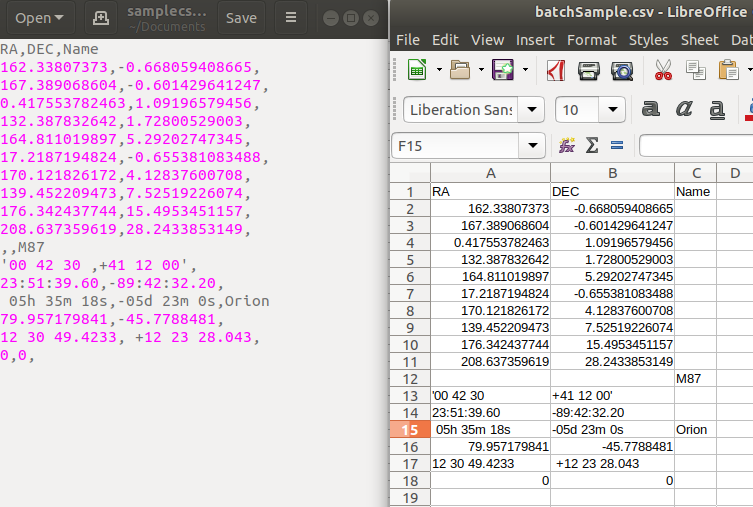
For multiple sources requests, users may upload a spreadsheet saved in CSV format or a CSV file via the "Browse" button instead of entering a Source name or Coordinates. One source can be specified per line. Currently, only the first 200 sources will be evaluated; future versions will extend this limit. The CSV file must at least have separate columns named RA and Dec (or any of the variants below, but there can only be one variant of RA and one of Dec per file). A column labelled "Name" may also be used. For a given source, coordinates will be evaluated via RA and Dec if they are non-empty.
If a line does not have a valid position, but does have a Name value, the service will attempt to resolve the Name. Column order does not matter.
Accepted variants of RA and Dec are:
- R.A.
- Right Ascension
- RA (J2000)
- R.A. (J2000)
- Right Ascension (J2000)
- RAJ2000
- DEC
- DEC.
- Declination
- DEC (J2000)
- DEC. (J2000)
- Declination (J2000)
- DecJ2000
Example Batch Request
Radius
The Search Radius around the specified source location resulting in square Cutouts of maximum width and height of 2 * radius.
The radius in arcminutes can be in range of 1-45.
Group By
- None (no mosaicking)
By default this service will display PNG previews of all rectangular images in the requested survey without doing any mosaicking. If the requested position and radius straddle boundaries in the input images for a given survey then all of the overlapping image sections will be returned separately. This is the group byNoneoption. -
DATE-OBS (mosaic when needed)
For some surveys (e.g., VLASS, ), there is a group byDATE-OBSoption that makes a Mosaic (when needed) for every uniqueDATE-OBS. This option will display PNG previews of all images byDATE-OBSin the requested survey. This grouping is provided for aiding variability studies. Mosaics are provided, for example, because some VLASS subtile overlaps may come from data taken in the same observation (observing tile). Mosaics are largely provided for visual use only.NOTE: Without mosaicking, in cases where the source location specified is included in more than Quicklook image because it is near the edge of the images, ALL images that the source location is found in are returned as results and if the radius specified spans over the edge of an image it will be truncated.
-
MOSAIC
For all surveys there is a GroupingMOSAICoption that provides a mosaicked PNG (and corresponding FITS file) if the requested position and radius straddle boundaries in the input images for a given survey. For an example of why this option is provided, consider that VLASS images are provided in a ~ 1 degree x 1 degree subtile image, where there can be a few arcminutes of overlap; however some users might want a larger cutout. The mosaic is largely provided for visual use only.
Query Output
PNG
Both a PNG file and links to download FITS files are made for every source in every survey, with one source per line outputted in a table. Different surveys have different recipes for converting FITS data to the PNG image.
VLASS Stretching and Normalization
Currently the VLASS cutouts are normalized to so that no data is clipped (MinMax normalization). This data is scaled to a greyscale color map using the arcsinh stretch with a default parameter of 0.1. Future versions may optimize PNG output or allow for different normalization/stretch/colormap options.
Downloads
-
FITS Structure:
If there was no mosaicking done then the resulting FITS image will have only a single extension with header. The mosaicked FITS images will have the mosaicked image as the first extension and it's corresponding updated header. The remaining extensions consist of the FITS images that were combined to form the mosaicked image. -
Single:
For each single PNG cutout preview, there will be a download button next to the image that will download the corresponding FITS file (with the base data, not the stretched data for the PNG).NOTE: Selecting the option [ ] only prepare mosaicked data will NOT include the input FITS images as extensions in the mosaicked image download. The download will have only the mosaicked image as the first extension and it's corresponding updated header.
-
Batch:
For each row of results provided there will be a checkbox column to select all images in that row for download, or fewer than all may be selected by clicking on the PNG cutout preview. When an image is selected for download there will be a red border around the PNG preview. To select all rows currently shown in the browser for download there will be a checkbox header column that toggles all checkboxes for each row below as selected or unselected. Clicking the "Download Batch" button will download all selected FITS images as a compressed tarball (".tgz") with separating folder names within for any rows with multiple FITS image results.NOTE: Selecting the option Prepare Mosaicked Data Singularly [ ] will NOT include the input FITS images as extensions in the mosaicked image downloads. The mosaicked downloads will have only the mosaicked image as the first extension and it's corresponding updated header.
-
FITS Filenames:
If there was no mosaicking done then the resulting FITS filename contains the central position of the tile from which the cut out was extracted. This is consistent with how cutout extraction works directly from the CADC database. If the resulting FITS image has been mosaicked with several images combined, then the resulting filename for that mosaicked FITS includes coordinates equal to the central position of the mosaicked cutout and an indication that the image has been mosaicked ('_mosaicked').
Mosaic Input Files
A plus sign (+) below the image will expand to show information about all images that went into each mosaicked image shown with the PNG preview and a download button to download the associated FITS files individually.
VLASS Quick Look Data
VLASS Quick Look images do not fully sample the PSF, and are cleaned to a threshold of ~5 sigma (details can be found in the weblogs for individual images). They are used for Quality Assurance and for transient searches, but should not be used for any other purpose. In addition to imaging artifacts, source positions can be off by up to 1-arcsec, and the flux density uncertainties are ~10-20%. For details, consult VLASS Memo 13.
Future versions of Quick Look images may apply corrections that provide for more accurate source positions. For details consult VLASS Memo 14.
Important Notices
This service uses Volatile Data hosted at the Canadian Astronomy Data Centre (CADC) for VLASS. These data records could be removed or altered or updated as time goes on and new data is collected so results from our service that uses the CADC data service can not be guaranteed to be 100% consistent over time.
The Quick Look images were made using a simplified imaging algorithm that does not correct for wide-field effects, resulting in significant positional and flux density errors, as well as poor image quality compared to a typical pointed observation with the VLA. Before using these images for scientific purposes, the NRAO VLASS Users' Guide to Quick Look images should be consulted.
Acknowledgement
If your research has benefited from this cutout server, we would appreciate if you could include the following acknowledgement in any resulting publication: This research has made use of the VLASS QLimage cutout server at URL cutouts.cirada.ca, operated by the Canadian Initiative for Radio Astronomy Data Analysis (CIRADA). CIRADA is funded by a grant from the Canada Foundation for Innovation 2017 Innovation Fund (Project 35999), as well as by the Provinces of Ontario, British Columbia, Alberta, Manitoba and Quebec, in collaboration with the National Research Council of Canada, the US National Radio Astronomy Observatory and Australia’s Commonwealth Scientific and Industrial Research Organisation.